

Climate Impacts and Poverty: Focus on Brazilian Favelas
Leveraging space to assess worsening natural disasters disproportionately impacting the most marginalized in Brazil
Welcome
Can we use satellite data to assess the impact and trends of natural disasters on the favelas of Brazilian cities - including total size of impact region and rebuilding of the region post disaster?
Are favelas disproportionately impacted by natural disasters (compared to other regions in the same city)?
Is there an economic impact to the region, community, and crop or farm yields (where most inhabitants of favelas work) during years and times of natural disasters? Is this trending with the increased loss of life as these disasters continue to escalate?
Can we use satellite data to better predict and prepare the community for natural disasters?
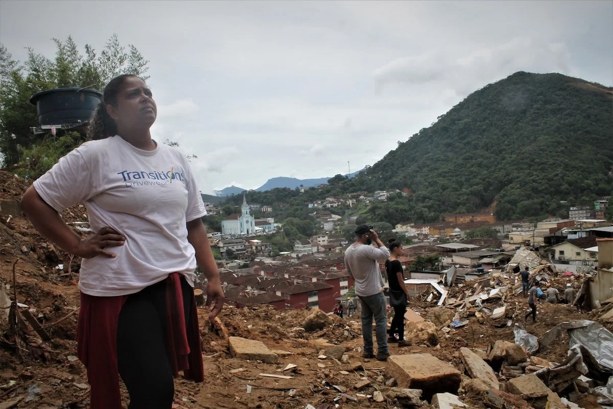
Brazil is a country of profound inequities. For decades, the largest cities in Brazil have locked the country's poorest out of the housing market, forcing them to the outskirts to build structurally unsafe and risky housing communities known as favelas, or Brazilian slums. Between 1985 and 2020, the amount of land occupied by favelas in Brazil nearly doubled. During the past few decades, the impacts of climate change in the Amazon region have also become more pronounced - with devastating effects to this area so critical to our planetary health.
This project seeks to understand how the growing risks of more severe and frequent natural disasters in Brazil caused by climate change - droughts, floods, and mudslides - are affecting the region’s most marginalized. Using satellite Earth Observation data from the past 10 years, we can track the progressive impacts of climate change on the favelas and the impossibility of the region to rebuild and withstand the increasing frequency of events. The project teams will look at data from before and after significant mudslides and flooding events in Brazil’s major cities over the past decade. Correlation of this data with regional income levels, death tolls, job availability for low-income workers, and farm and crop yields for major exports (acai, coffee, and shrimp) will allow us to better understand the widespread impact of climate change on Brazil, its people, and its economy.
Problem Statements
Understanding the Problem: Background Resources

Climate Migration
Landslide Track Resources
Below is a list of resources and data sets that are applicable this tracks and are a helpful way to get started.
(Thanks to the Awesome GEE Community Catalog for these data sets!)
Global high-resolution floodplains
Land Change Monitoring, Assessment, and Projection (LCMAP)
Global large flood events : Dartmouth Flood Observatory (1985-2016)
RADD - RAdar for Detecting Deforestation - Near real-time disturbances in humid tropical forest based on Sentinel-1 at 10m spatial scale
Benchmark maps of 33 years of secondary forest age for Brazil (1986-2019)
Mapbiomas Annual land cover and use maps
Global Landslide Catalog :NASA Goddard (1970-2019)
Open building footprints around the world (Bing Maps)
Samapriya Roy, Erin Trochim, Valerie Pasquarella, Édith Darin, & Tyson Swetnam. (2023). samapriya/awesome-gee-community-datasets: Community Catalog (1.0.5). Zenodo. https://doi.org/10.5281/zenodo.7712869