
Environmental Migration
in Sahelian Africa
For generations, the people of the Sahel have built thriving communities in a harsh landscape. The Fulani guide their cattle across vast drylands, following seasonal pastures that have sustained their herds for centuries. The Tuareg have constructed vast trans-Saharan trade routes supported by oasis settlements. The Kanuri have built vast fishing communities along the waters of Lake Chad. The Bambara farm Mali’s dry central plains, using innovative techniques such as zai pits to restore soil fertility and conserve scarce water. These groups, among many others, have long adapted to the Sahel’s shifting climate.
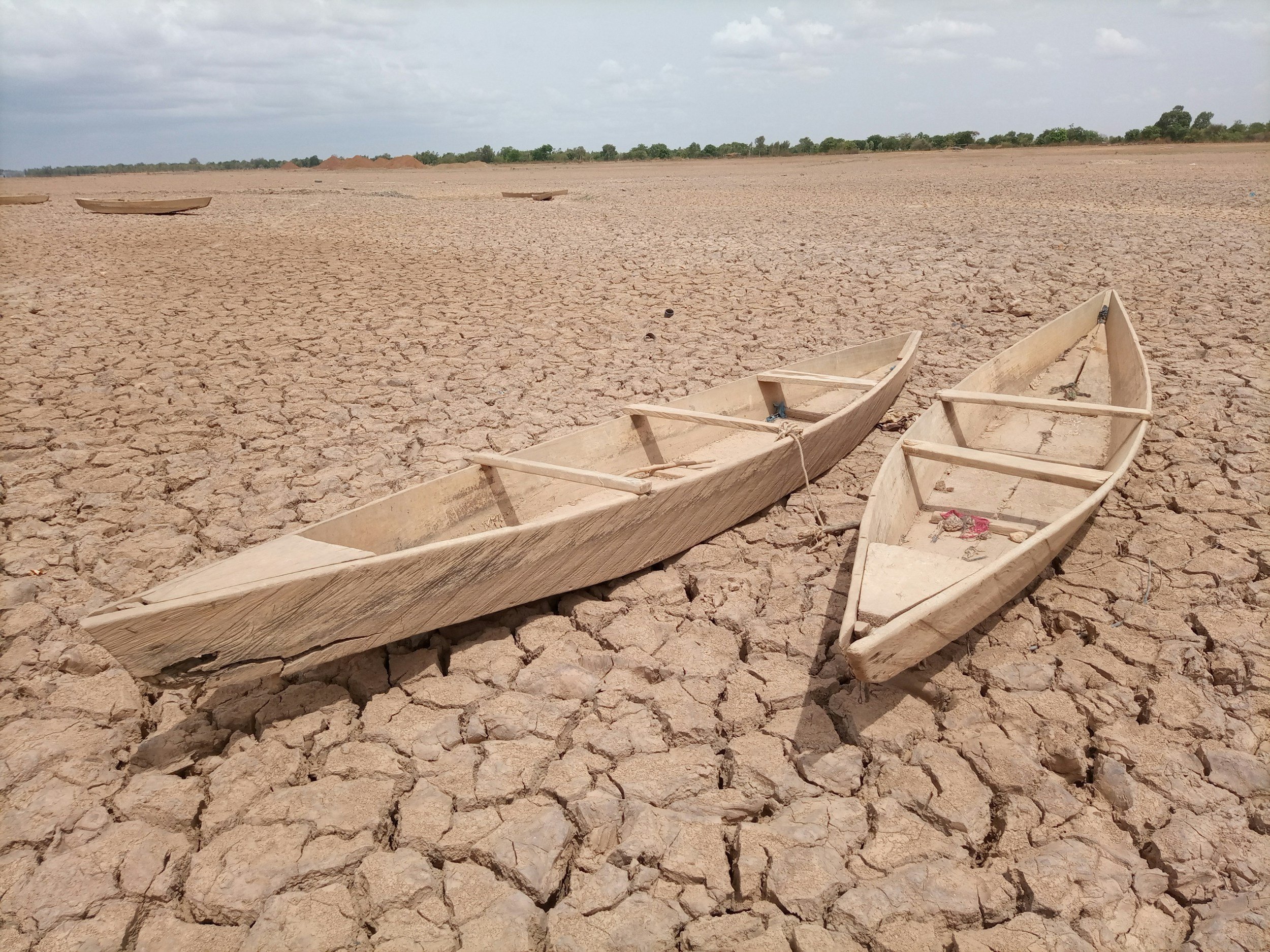
However, today, the pace of change is accelerating. Droughts stretch longer, seasonal rains arrive too late or too forcefully—eroding the soil. Grasslands shrink. Wells run dry. Lake Chad has greatly receded. Collecting firewood, once a short morning task, may require miles of travel. The ecosystems that sustained these ways of life for centuries are rapidly shifting. With fewer options to survive, many families have no choice but to leave.
As resources dwindle and migration rises, tensions grow. Competition over land and water is fueling disputes between farmers and herders, while extremist groups exploit instability to expand their influence. Urban centers across the Sahel are expanding rapidly, but often without proper infrastructure, services, or job opportunities for those arriving. The question is: how can we understand these patterns? How can we use data to anticipate these changes and design solutions that help communities adapt before they are forced to leave?
Research Questions
What regions of the Sahel are experiencing the most severe environmental degradation?
Where is migration happening, and which cities and towns are seeing the largest influx of environmental migrants? Are there patterns linking areas of environmental stress to violent conflict?
What environmental factors (e.g., drought frequency, declining farmland, water shortages) are most strongly correlated with displacement? Can spatial analysis help identify emerging hotspots of migration risk?
Are there successful strategies—such as water conservation, reforestation, or infrastructure development—that could help communities adapt rather than migrate? How can satellite data be used to support these solutions?
Track Resources
Contextual Documents:
Adekola Olalekan, 2018, "Nigeria’s conflict is a result of environmental devastation across West Africa", The Conversation
Vigil Sara, 2017, "Climate Change and Migration: Insights from the Sahel", in Carbone Giovanni (ed), Out of Africa, Why People Migrate, Ledizioni
UN Office for the Coordination of Humanitarian Affairs, 2011, Livelihood Security: Climate Change, Migration and Conflict in the Sahel
Beyond the crisis narratives, there is much beauty, strength and resilience in the Sahelian story
Data sources (non-restrictive)
1. Urbanization and Settlement Data
Global Human Settlement Layer (GHSL): Provides global spatial data on built-up areas, population density, and urbanization patterns over time. It includes layers for population grids, settlement extent, and urban areas, derived from satellite imagery and census data.
https://developers.google.com/earth-engine/datasets/catalog/JRC_GHSL_P2023A_GHS_BUILT_C
https://developers.google.com/earth-engine/datasets/catalog/DLR_WSF_WSF2015_v1#description
GHSL, 1975 to 2030 in 5 year intervals: https://developers.google.com/earth-engine/datasets/catalog/JRC_GHSL_P2023A_GHS_BUILT_S
2. Land Artificialization and Land Cover
3. Global Demography
Gridded Population of the World (GPW): Global population density dataset
WorldPop: Spatial demographic data and population growth projections
WorldPop Global Project Population Data: Estimated Residential Population per 100x100m Grid Square
4. Vegetation and Forest Cover
MODIS Vegetation Indices (NDVI): Global vegetation indices derived from MODIS satellites
Global Forest Change: Data on forest cover, loss, and gain globally
5. Land Degradation
Trends.Earth: Tool for assessing and mapping land degradation based on UNCCD indicators
FAO's Land Degradation Database (GLADIS): Data on land degradation and human pressures
6. Hydrology and Watercourses
HydroSHEDS: Global hydrological networks and watershed data
Global Surface Water Dataset (JRC): Data on the dynamics of global surface water bodies
7. Additional Resources, including “Global conflict” datasets: